Shape Types#

Point Layer#

Sphere | Cylinder | Cone | Box | Disk | Plane | Point | Billboard | Model File

Sphere#
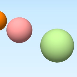
_images/Sphere.jpg
Specific settings
  • Radius

    Radius of the sphere (numeric value).

Origin

The center of the sphere

three.js geometry class

SphereGeometry

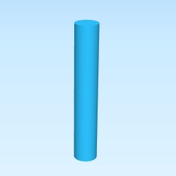
Cylinder#

_images/Cylinder.jpg
Specific settings
  • Radius

    Radius of the cylinder (numeric value).

  • Height

    Height of the cylinder (numeric value).

Origin

The bottom center of the cylinder (when height > 0)

three.js geometry class

CylinderGeometry

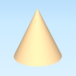
Cone#

_images/Cone.jpg
Specific settings
  • Radius

    Radius of the cone (numeric value).

  • Height

    Height of the cone (numeric value).

Origin

The bottom center of the cone (when height > 0)

three.js geometry class

CylinderGeometry

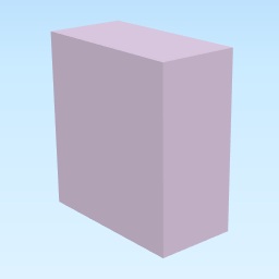
Box#

_images/Box.jpg
Specific settings
  • Width

    Width of the box (size in the X axis, numeric value).

  • Depth

    Depth of the box (size in the Y axis, numeric value).

  • Height

    Height of the box (size in the Z axis, numeric value).

Origin

The bottom center of the box (when height > 0)

three.js geometry class

BoxGeometry

Note

In three.js, height is along the Y axis. Qgis2threejs uses the Z axis for height.

Disk#

_images/Disk.jpg
Specific settings
  • Radius

    Radius of the disk (numeric value).

  • Dip

    Dip angle in degrees. See Strike and dip.

  • Dip direction

    Azimuth of the maximum dip direction (clockwise from north, degrees).

Origin

The center of the disk

three.js geometry class

CircleGeometry

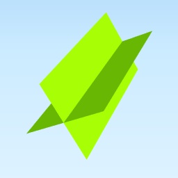
Plane#

_images/Plane.jpg
Specific settings
  • Width

    Width of the plane in strike direction (numeric value).

  • Length

    Length of the plane in dip direction (numeric value).

  • Dip

    Dip angle in degrees. See Strike and dip.

  • Dip direction

    Azimuth of the maximum dip direction (clockwise from north, degrees).

Origin

The center of the plane

three.js geometry class

PlaneGeometry

Point#

_images/Point.jpg

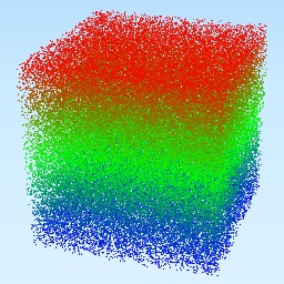
100,000 randomly generated 3D points colored by their Z values#

Specific settings
  • Size (in Material tab)

    Size of the points in pixels.

Origin

The center of the object.

three.js object class

Points

Billboard#

An image that always faces the camera. When an image file on local file system is specified, the image file is copied to the export destination. When an image file on a web server is specified, the image file is not copied.

_images/no_image.png
Specific settings
  • Image file

    File path or URL. If you enter a file path or URL directly, enclose it in single quotation marks.

  • Scale

    Width of the sprite in world units (same units as map coordinates). The height is automatically calculated from this value to preserve the aspect ratio of the image.

Origin

The center of the sprite.

three.js object class

Sprite

Model File#

Load a 3D model from a supported model file format. COLLADA (*.dae) and glTF (*.gltf, *.glb) are supported. When a model file on the local file system is specified, the model file is copied to the export destination. After export, you need to copy any associated files such as texture image. When a model file URL is specified, the model file is referenced and not copied.

_images/no_image.png
Specific settings
  • Model file

    File path or URL. If you enter a file path or URL directly, enclose it in single quotation marks.

  • Scale

    A numeric value.

  • Rotation (x)

    Rotation around the X axis in degrees. Positive values rotate the model according to the right-hand rule.

  • Rotation (y)

    Rotation around the Y axis in degrees. Positive values rotate the model according to the right-hand rule.

  • Rotation (z)

    Rotation around the Z axis in degrees. Positive values rotate the model according to the right-hand rule.

  • Rotation Order

    The options are XYZ, YZX, ZXY, XZY, YXZ and ZYX. See Euler - three.js docs.

Origin

The origin of the model

Line Layer#

Line | Pipe | Cone | Box | Wall

Line#
_images/Line.png

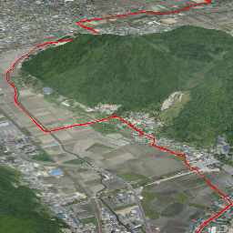
Image created using GSI Tiles (ort, dem) provided by GSI (Japan).#

Specific settings

None

three.js object class:

Line

Pipe#

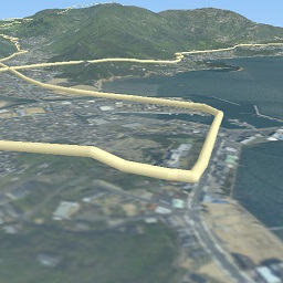
Places a cylinder along each line segment and a sphere to each vertex.
_images/Pipe.jpg

Image created using GSI Tiles (airphoto, dem).#

Specific settings
  • Radius

    Radius of the pipe (numeric value).

three.js geometry classes:

CylinderGeometry and SphereGeoemtry

Cone#

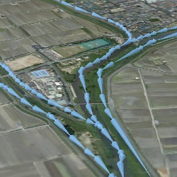
Places a cone along each line segment. The cone is oriented in the forward direction of the line.
_images/ConeL.jpg

Image created using GSI Tiles (ort, dem) provided by GSI (Japan), and river data from National Land Numerical Information provided by MLIT (Japan).#

Specific settings
  • Radius

    Radius of the cone (numeric value).

three.js geometry class

CylinderGeometry

Box#

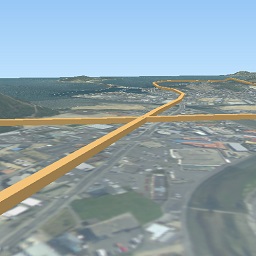
Places a box along each line segment.
_images/Box1.jpg

Image created using GSI Tiles (airphoto, dem).#

Specific settings
  • Width

    Width of the box (numeric value).

  • Height

    Height of the box (numeric value).

three.js geometry class

BoxGeometry

Wall#

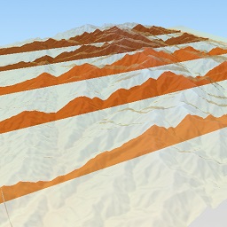
Creates a vertical wall from each line segment down to a specified Z value.
_images/Wall.jpg

Image created using SRTM3 elevation data.#

Specific settings
  • Other side Z

    The Z coordinate of the opposite edge of the wall (numeric value).

Polygon Layer#

Polygon | Extruded | Overlay

Polygon#

_images/Polygon.jpg

Image created using the 3D City Model data of Shinjuku from Project PLATEAU provided by MLIT (Japan) and GSI Tiles (ort, dem) provided by GSI (Japan).#

Specific settings

None

Extruded#

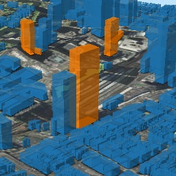
Extrudes the polygon vertically to create a 3D object.
_images/Extruded.jpg

Image created using GSI Tiles (ort, dem) and OpenStreetMap (© OpenStreetMap contributors, License).#

Specific settings
  • Height

    The extrusion height of the polygon (numeric value).

Overlay#

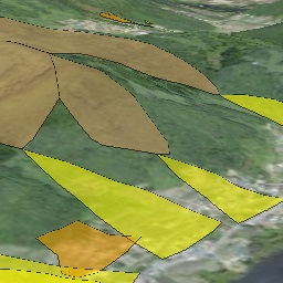
Overlays the polygon on the main DEM with a specified fill color, border color and opacity. When the altitude mode is Relative to DEM layer, the polygon is placed at a height relative to the DEM surface. Otherwise, a flat polygon is created at the specified altitude.
_images/Overlay.jpg

Image created using GSI Tiles (ort, dem) and the Sediment Disaster Hazard Area data of Okayama from National Land Numerical Information.#

Specific settings
  • Border

    No border, feature style, random color, or expression.